


April 2012 Update: We’re done! We climbed Texas’s Guadalupe Peak – high point #50 – on 2/25/12. Click on a state in the list below for a trip report. Scroll down for the requisite nerdy graph.

| Alabama | Indiana | Nebraska | South Carolina |
|---|
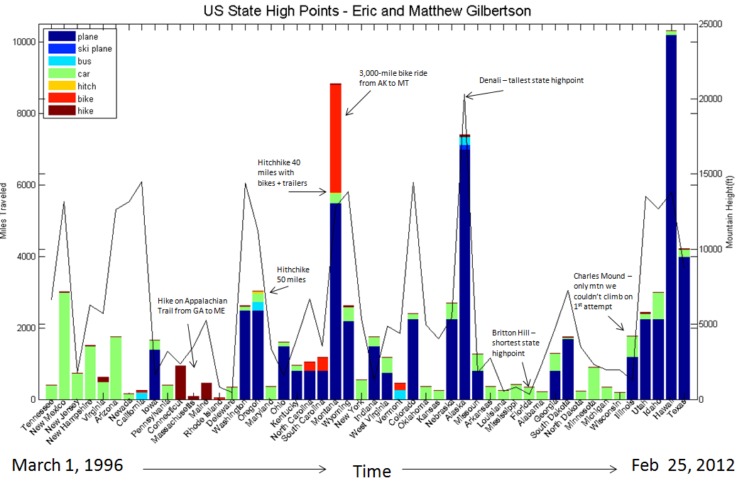
An effort graph, showing the different modes of transportation we used to reach each of the state high points. Each color represents a different mode of transportation. On the X-axis is state and time (increasing from L-R). On the left Y-axis is the miles traveled for each mode of transportation, while the right Y-axis measures the mountain height, depicted by the thin black line.
You must be logged in to post a comment.